Alle Bilder die die Vorlage:Bild-CC-by-2.5 verwenden.
Mediendateien in Kategorie "Bild-CC-by-2.5"
Folgende 200 Dateien sind in dieser Kategorie, von 262 insgesamt.
(vorherige Seite) (nächste Seite)-
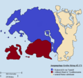
 Abgeschworenenreich.png 1.023 × 751; 83 KB
-
 Abwasserkanäle.jpg 689 × 651; 248 KB
-
 Achtzigjähriger Krieg.png 799 × 531; 31 KB
-
 Almanach SI Map.gif 50 × 32; 2 KB
-
 Almanach-Button.jpg 20 × 21; 2 KB
-
 Almanach-Symbol.png 135 × 135; 13 KB
-
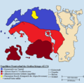
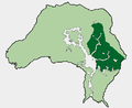
 Alte Fürstentümer.png 1.023 × 751; 204 KB
-
 Arenaportal.jpg 460 × 60; 55 KB
-
 Arnesischer Krieg.png 618 × 463; 23 KB
-
 Aufbau Aurbis.gif 800 × 600; 44 KB
-
 Ausbreitung Knahaten-Grippen.png 799 × 558; 23 KB
-
 Ayleid A.gif 10 × 15; 900 Bytes
-
 Ayleid B.gif 9 × 15; 864 Bytes
-
 Ayleid C.gif 10 × 15; 879 Bytes
-
 Ayleid D.gif 12 × 15; 888 Bytes
-
 Ayleid E.gif 11 × 15; 883 Bytes
-
 Ayleid G.gif 12 × 15; 913 Bytes
-
 Ayleid H.gif 10 × 15; 886 Bytes
-
 Ayleid I.gif 9 × 15; 879 Bytes
-
 Ayleid K.gif 7 × 15; 888 Bytes
-
 Ayleid L.gif 7 × 15; 860 Bytes
-
 Ayleid M.gif 9 × 15; 905 Bytes
-
 Ayleid N.gif 11 × 15; 913 Bytes
-
 Ayleid O.gif 12 × 15; 913 Bytes
-
 Ayleid R.gif 12 × 15; 907 Bytes
-
 Ayleid S.gif 12 × 15; 931 Bytes
-
 Ayleid T.gif 9 × 15; 883 Bytes
-
 Ayleid U.gif 15 × 15; 914 Bytes
-
 Ayleid V.gif 10 × 15; 897 Bytes
-
 Ayleid Y.gif 11 × 15; 904 Bytes
-
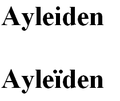 Ayleiden Schreibweisen.png 210 × 177; 4 KB
-
 Bevölkerungsverteilung Cyrodiil.PNG 421 × 273; 9 KB
-
 Bevölkerungsverteilung-Vvardenfell.png 475 × 378; 12 KB
-
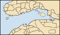
 Bjoulsae.png 943 × 598; 24 KB
-
 Camoranischer Usurpator.png 799 × 680; 30 KB
-
 DF Brustharnischtypen.PNG 449 × 161; 11 KB
-
 DF Streitkolben - Farbunterschiede.PNG 341 × 226; 12 KB
-
 Die Großen Drei 3Ä 433.png 640 × 381; 15 KB
-
 Die großen Drei.png 640 × 381; 22 KB
-
 Die Türme.jpg 628 × 475; 69 KB
-
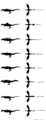 Drachenformen.png 1.272 × 3.309; 231 KB
-
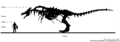 Drachenskelett - Größenvergleich.png 1.130 × 395; 111 KB
-
 Einigungskriege.gif 799 × 558; 98 KB
-
 Eldenhain Lage.jpg 814 × 624; 77 KB
-
 Elfische Siedlungsgebiete.png 874 × 629; 40 KB
-
 Erstes Reich der Nordmänner.png 799 × 558; 31 KB
-
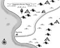
 Fahler Pass-Kleine Karte.jpg 1.102 × 1.619; 1,4 MB
-
 Fahler Pass-Schatz Fundorte.jpg 1.102 × 1.619; 1,41 MB
-
 Feder gold.gif 44 × 51; 896 Bytes
-
 Feder silber.gif 44 × 51; 896 Bytes
-
 Flagge Karte klein.png 20 × 20; 1 KB
-
 Flagge Karte.png 30 × 30; 2 KB
-
 Flugbahn Umbriel.jpg 799 × 558; 165 KB
-
 Fläche-Musterbeispiel.png 775 × 583; 152 KB
-
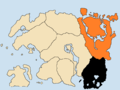
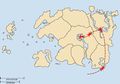
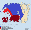
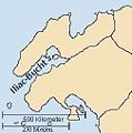
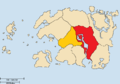
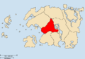
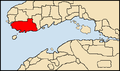
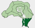
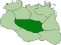
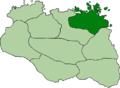
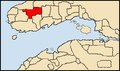
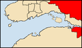
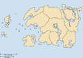
 Fürstentümer Himmelsrands.png 1.023 × 751; 186 KB
-
 Gebietsänderungen Himmelsrands.png 1.431 × 788; 61 KB
-
 Grenzänderungen Elsweyrs.png 592 × 912; 39 KB
-
 Großer Krieg Folgen.png 618 × 651; 44 KB
-
 Großer Krieg Fronten 4Ä 172.png 618 × 594; 37 KB
-
 Großer Krieg Fronten 4Ä 174.png 618 × 614; 43 KB
-
 Großer Krieg Konfliktparteien.png 618 × 584; 33 KB
-
 Haken.gif 23 × 20; 86 Bytes
-
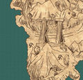
 Herneströmung.jpg 765 × 931; 634 KB
-
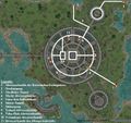
 Hilfe Weiterleitung Editor.jpg 585 × 67; 15 KB
-
 Himmelsrand-Karte Symbol.png 300 × 190; 31 KB
-
 Himmelsrand-Karte-kl.png 50 × 32; 3 KB
-
 Icon ayleidwell.gif 16 × 16; 1 KB
-
 Icon corpse.gif 16 × 16; 417 Bytes
-
 Icon door.gif 16 × 16; 1.018 Bytes
-
 Icon dunmer.gif 16 × 16; 377 Bytes
-
 Icon dwemer.gif 16 × 16; 571 Bytes
-
 Icon fighterguild.gif 16 × 16; 357 Bytes
-
 Icon house.gif 16 × 16; 621 Bytes
-
 Icon Infobox.png 55 × 70; 6 KB
-
 Icon kristall 2.gif 16 × 16; 357 Bytes
-
 Icon kristall.gif 16 × 16; 360 Bytes
-
 Icon mageguild.gif 16 × 16; 1 KB
-
 Icon menhir.gif 16 × 16; 229 Bytes
-
 Icon misc.gif 16 × 16; 221 Bytes
-
 Icon misc2.gif 16 × 16; 346 Bytes
-
 Icon npc.gif 16 × 16; 363 Bytes
-
 Icon obelisk.gif 16 × 16; 970 Bytes
-
 Icon shop.gif 16 × 16; 607 Bytes
-
 Icon shrine.gif 16 × 16; 356 Bytes
-
 Icon shrine2.gif 16 × 16; 374 Bytes
-
 Icon shrine3.gif 16 × 16; 633 Bytes
-
 Icon smith.gif 16 × 16; 361 Bytes
-
 Icon temple.gif 16 × 16; 369 Bytes
-
 ICQ Flower.jpg 50 × 50; 24 KB
-
 Iliac Bucht nummeriert 3Ä 433.png 640 × 381; 17 KB
-
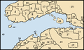 Iliac-Bucht nummeriert.png 640 × 381; 29 KB
-
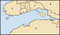
 Illiac Bucht.JPG 252 × 255; 14 KB
-
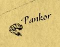 Insel Pankor.jpg 141 × 110; 7 KB
-
 Kaiserliche Provinz Akavir.jpg 683 × 544; 55 KB
-
 Kaiserreich 2Ä 864.png 799 × 558; 26 KB
-
 Kaiserreich 4Ä 176.png 799 × 558; 20 KB
-
 Kaiserreich 4Ä 29.png 799 × 558; 20 KB
-
 Karte Dwemer-Ruine Stros M'Kai Außen.jpg 677 × 647; 128 KB
-
 Karte Dwemer-Ruine Stros M'Kai.jpg 1.200 × 1.100; 344 KB
-
 Karte Gorne.jpg 234 × 275; 18 KB
-
 Karte Konföderation von Elsweyr.png 592 × 655; 26 KB
-
 Karte Solstheim.jpg 720 × 785; 153 KB
-
 Karte Sotha Sil.jpg 784 × 624; 34 KB
-
 Karte Stros MKai.jpg 707 × 556; 93 KB
-
 Karte von Sutch.jpg 1.191 × 485; 181 KB
-
 Karte-Azras-Kreuzung.jpg 600 × 569; 95 KB
-
 KdER Karte Ausgangslage.jpg 236 × 281; 48 KB
-
 KdER Karte dwe Vormarsch.jpg 236 × 281; 45 KB
-
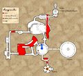
 Kolb und der Drache Schema.png 790 × 648; 21 KB
-
 Krieg der Rechtschaffenheit.png 799 × 557; 30 KB
-
 Krieg des Roten Diamanten - Machtbereiche 3Ä 120.png 618 × 464; 21 KB
-
 Krieg des Roten Diamanten - Machtbereiche 3Ä 121.png 618 × 464; 21 KB
-
 Krieg des Roten Diamanten - Machtbereiche 3Ä 127.png 618 × 464; 21 KB
-
 Krieg des Roten Diamanten - Machtbereiche 3Ä 137.png 618 × 464; 21 KB
-
 Krieg von Bend'r-mahk.png 618 × 463; 23 KB
-
 Lage Abibon-Gora.png 640 × 381; 22 KB
-
 Lage Alcaire.png 640 × 381; 22 KB
-
 Lage Aldmeri-Bund.png 799 × 558; 26 KB
-
 Lage Aldmeri-Bund2.png 799 × 558; 25 KB
-
 Lage Alessianisches Kaiserreich 1Ä 482.png 799 × 557; 27 KB
-
 Lage Alik'r.png 640 × 381; 22 KB
-
 Lage Alik'ra.png 640 × 381; 22 KB
-
 Lage Anticlere.png 640 × 381; 22 KB
-
 Lage Antiphyllos.png 640 × 381; 22 KB
-
 Lage Ayasofya.png 640 × 381; 22 KB
-
 Lage Balfiera.png 640 × 381; 22 KB
-
 Lage Bergama.png 640 × 381; 22 KB
-
 Lage Betonia.png 640 × 381; 22 KB
-
 Lage Bhoriane.png 640 × 381; 22 KB
-
 Lage Colovianischer Staatenbund 1Ä 478.png 799 × 557; 30 KB
-
 Lage Colovianisches Hochland.PNG 1.024 × 836; 44 KB
-
 Lage Cybiades.png 640 × 381; 22 KB
-
 Lage Cyrodiil.png 799 × 558; 27 KB
-
 Lage Daenia.png 640 × 381; 22 KB
-
 Lage Daggerfall 3Ä 433.png 640 × 381; 15 KB
-
 Lage Daggerfall.png 640 × 381; 22 KB
-
 Lage Dak'fron.png 640 × 381; 22 KB
-
 Lage Dementia.PNG 742 × 716; 40 KB
-
 Lage Dirennireich.png 799 × 558; 19 KB
-
 Lage Dolchsturz-Bündnis.png 799 × 558; 20 KB
-
 Lage Drachenschwanzberge.png 640 × 381; 22 KB
-
 Lage Dunkelforst.PNG 1.024 × 836; 44 KB
-
 Lage Dwynnen.png 640 × 381; 22 KB
-
 Lage Ebenherz-Pakt.png 799 × 558; 21 KB
-
 Lage Elsweyr.png 799 × 558; 27 KB
-
 Lage Ephesus.png 640 × 381; 22 KB
-
 Lage Felsschlucht.png 640 × 381; 22 KB
-
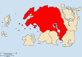
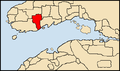
 Lage Fürstentum Falkenring.png 823 × 603; 165 KB
-
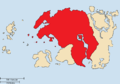
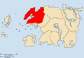
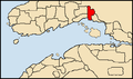
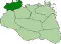 Lage Fürstentum Haafingar.png 823 × 603; 164 KB
-
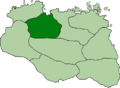 Lage Fürstentum Hjaalmarsch.png 823 × 603; 164 KB
-
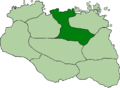
 Lage Fürstentum Ostmarsch.png 823 × 603; 165 KB
-
 Lage Fürstentum Pale.png 823 × 603; 165 KB
-
 Lage Fürstentum Reach.png 823 × 603; 158 KB
-
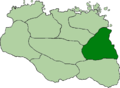
 Lage Fürstentum Rift.png 823 × 603; 160 KB
-
 Lage Fürstentum Weißlauf.png 823 × 603; 160 KB
-
 Lage Fürstentum Winterfeste.png 823 × 603; 160 KB
-
 Lage Gavaudon.png 640 × 381; 22 KB
-
 Lage Glenumbria Moor.png 640 × 381; 22 KB
-
 Lage Goldküste.PNG 1.024 × 836; 44 KB
-
 Lage Großer Forst.PNG 1.024 × 836; 44 KB
-
 Lage Hammerfell.png 799 × 558; 27 KB
-
 Lage Herzland.PNG 1.024 × 836; 44 KB
-
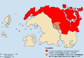
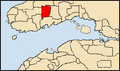
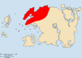
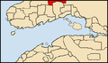
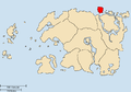
 Lage Himmelsrand.png 799 × 558; 27 KB
-
 Lage Hochfels.png 799 × 558; 27 KB
-
 Lage Ilessanische Hügel.png 640 × 381; 22 KB
-
 Lage Jerall-Berge.PNG 1.024 × 836; 44 KB
-
 Lage Kairou.png 640 × 381; 22 KB
-
 Lage Kaiserreich von Tamriel.png 799 × 558; 24 KB
-
 Lage Kambrien.png 640 × 381; 22 KB
-
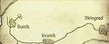
 Lage Kevalla.jpg 160 × 94; 7 KB
-
 Lage Koegria.png 640 × 381; 22 KB
-
 Lage Konföderation von Elsweyr.png 799 × 558; 26 KB
-
 Lage Kozanset.png 640 × 381; 22 KB
-
 Lage Lainlyn.png 640 × 381; 22 KB
-
 Lage Mania.PNG 742 × 716; 40 KB
-
 Lage Menevia.png 640 × 381; 22 KB
-
 Lage Mournoth.png 640 × 381; 22 KB
-
 Lage Myrkwasa.png 640 × 381; 22 KB
-
 Lage Nibenay Großregion.PNG 1.024 × 836; 39 KB
-
 Lage Nibenay-Tal.png 1.024 × 836; 45 KB
-
 Lage Nordmoor.png 640 × 381; 22 KB
-
 Lage Orsinium 3Ä 433.png 640 × 381; 15 KB
-
 Lage Orsinium.png 640 × 381; 22 KB
-
 Lage Phrygias.png 640 × 381; 22 KB
-
 Lage Pothago.png 640 × 381; 22 KB
-
 Lage Provinz Morrowind.png 799 × 558; 27 KB
-
 Lage Randland.PNG 742 × 716; 39 KB
-
 Lage Santaki.png 640 × 381; 22 KB
-
 Lage Satakalaam.png 640 × 381; 22 KB
-
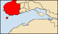
 Lage Schwarzmarsch.png 799 × 558; 27 KB
-
 Lage Sentinel 3Ä 433.png 640 × 381; 15 KB
-
 Lage Sentinel.png 640 × 381; 22 KB
-
 Lage Shalgora.png 640 × 381; 22 KB
-
 Lage Siedlungsgebiet Nibenay.png 1.024 × 836; 39 KB
-
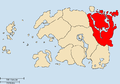
 Lage Solstheim.png 799 × 558; 27 KB
-
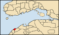
 Lage Stirk.png 799 × 558; 27 KB
-
 Lage Stros MKai.jpg 677 × 528; 63 KB
-
 Lage Summerset.png 799 × 558; 27 KB
-
 Lage Tigonus.png 640 × 381; 22 KB
-
 Lage Totambu.png 640 × 381; 22 KB


