Keine Bearbeitungszusammenfassung |
Keine Bearbeitungszusammenfassung |
||
| Zeile 9: | Zeile 9: | ||
<div style="display:none;"></noinclude> | <div style="display:none;"></noinclude> | ||
<div style="position: relative; width: 300px; height: 331px; overflow: hidden"> | <div style="position: relative; width: 300px; height: 331px; overflow: hidden"> | ||
<div style="position: absolute; top: 0px; left: 0px; font-size: 100px; overflow: hidden; line-height: 100px; z-index: 2">[[Datei:Karte Solstheim groß.jpg|link=http://almanach.scharesoft.de/nirn/?lng={{{3}}}&lat={{{4}}}&zoom={{{5}}}|300x331px]]</div><div style="position: absolute; top: {{{2}}}px; left: {{{1}}}px; z-index: 3">[[Datei: | <div style="position: absolute; top: 0px; left: 0px; font-size: 100px; overflow: hidden; line-height: 100px; z-index: 2">[[Datei:Karte Solstheim groß.jpg|link=http://almanach.scharesoft.de/nirn/?lng={{{3}}}&lat={{{4}}}&zoom={{{5}}}|300x331px]]</div><div style="position: absolute; top: {{{2}}}px; left: {{{1}}}px; z-index: 3">[[Datei:Flagge Karte.png|link=http://almanach.scharesoft.de/nirn/?lng={{{3}}}&lat={{{4}}}&zoom={{{5}}}||30x30px]]</div></div><noinclude></div></noinclude> | ||
Aktuelle Version vom 12. Februar 2013, 22:14 Uhr
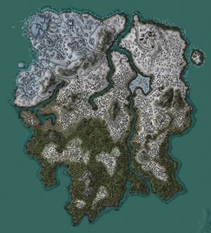
Zur Einbindung von Kartenpositionen. Speziell für die Einbindung in Vorlagen geeignet. Zur Einbindung von Positionskarten in Thumbnails existiert die eigene Vorlage: Lage Solstheim Thumb.
{{Lage Solstheim|Breite|Höhe|X-Koordinate|Y-Koordinate|Zoomstufe}}
Zum Beispiel liefert {{Lage Solstheim|80|218|-177.66982555389404|89.32713031768799|16|Lage von Rabenfels}} die Lage von Rabenfels.
